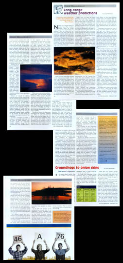
| Yellow Grass, Saskatchewan |
 |
| Yellow Grass, Saskatchewan |
|
|
Portfolio Gallery Contact Ordering Home |
Portfolio Samples
By Lorne McClinton For Top Crop Manager "Everyone talks about the weather, but nobody does anything about it." - Mark Twain Nothing has a bigger impact on farmers than the weather. Farmers spend all winter researching markets and planning crop rotations. They can choose the best seed varieties and plant with the top equipment available, fertilize precisely to soil tests and make use of the latest herbicides, fungicides and pesticides on the market. Despite all this work it’s still possible to have a crop failure because the weather has refused to co-operate. Nothing would reduce the risk in farming more than accurate long range weather forecasts. "Really accurate long range forecasts would dramatically impact how I farm," says Richard Erb, a grain farmer near Yellow Grass, Sask. "It would impact both the types of crops and the types of inputs that I would choose. The equipment side would also be influenced. If I knew for certain that it was going to be a hot dry year, I would up my acres of crops like lentils and chick peas. I would definitely cut back on my canolas and I would plant my wheat quite early to get away from the heat in the flowering stage. "Right now how we base all these decisions on how dry it is in early spring. We look at this snap shot in time and then hedge our bets. If we had accurate long term forecasting we would have a lot more certainty and farming wouldn’t be such a crap shoot. We are betting too much and we are too heavily capitalized to be going in there with just a 50% chance of something occurring. That’s why stress levels are going up. There is too much chance for error and unless you are exceedingly well financed, there is not much room for error." In early November 2000, Environment Canada’s Long Range forecast was for the Prairies to have a warmer than normal winter with normal precipitation. It predicted that spring 2001 would see normal temperatures on the prairies but wetter than usual conditions. Summer 2001 temperatures were expected to be normal with wetter than normal conditions prevailing. Predictions can be found at Environment Canada’s website. http://www.cmc.ec.gc.ca/climate/climate_outlook.htm. How accurate are long range predictions? Farmers like Richard Erb have little faith in them at present. "The long range forecasts are rather iffy," Erb says. "The three to five month forecasts are like tossing a stone at the moon. Today we have better decision making tools at our disposal than our fathers did for everything but the weather. When we try to make decisions on what the weather will do in that particular year we don’t have any better information than my dad did in 1960." "Long range forecasting has come a long ways from where we were twenty years ago," says Virginia Wittrock, a climatologist with the Saskatchewan Research Council in Saskatoon. "Two winters ago when farmers in my area asked what the coming spring would be like I was able to tell them that it would be a late spring. Later they said- I know you said it was going to be a late spring but did it have to be this late? I could not have told the neighbor that it was going to be a late spring, unless forecasting had developed this far. "We are still at least five to ten years away from being able to do what farmer’s would like. Knowing that the summer is going to be cooler and wetter overall is useful, but it doesn’t help a whole lot when trying to decide whether or not wheat or peas should be planted this year. It is a long way away until we can project when the last spring frost and first fall frost are going to be. You are still going to have variable weather. You are still going to get downpours like Vanguard had last year." Research indicates that long term weather is largely determined by what is happening in the oceans. Atmospheric weather circulation occurs too rapidly to be useful for season-long weather predictions. "Ocean circulation patterns and atmosphere circulation patterns are linked, " says Ted O’Brien, with the PFRA’s Prairie Agroclimate Unit in Regina, Sask. "This is an extremely complex science because there are so many factors to try to model or discern." At present the El Nino current in the South Pacific, called the El Nino Southern Oscillation, or ENSO, provides the most consistent indicator for long range weather predictions in Western Canada. Under normal conditions the trade winds off South America blow towards the west, across the tropical Pacific. These winds pile up warm surface water in the west Pacific. The sea surface is about 1/2 meter higher at Indonesia than at Ecuador. During an El Nino event the trade winds relax and the warm water shifts eastwards towards the coast of Peru. Rainfall patterns shift eastwards with the warm water leading to floods in Peru and droughts in Australia and Indonesia. As the warm water shifts eastwards it heats the atmosphere above it causing large changes in the global atmospheric circulation. When this happens weather is affected around the world. "Twenty out of the last twenty-three El Nino events have brought generally warmer, drier winters to the prairies," O’Brien says. "That is not to say that there were not colder intrusions, but generally, across the prairies, temperatures were warmer. We feel this has had a fairly consistent impact on both perennial crops and livestock production. Warmer, open conditions can lead to more grazing on pasture land.
"Maybe we should be alerting producers that an El Nino winter brings the risk of warmer, dryer conditions and tends to have an impact on first cut hay yield, O"Brien says. "For example if we are entering an El Nino winter with its potential for warmer weather conditions and lower run off, perhaps producers should consider having low dugouts pumped full. These questions provide consistent signals for the farmer. Right now this is the strongest long range weather signal available for the prairies. El Nino events do not offer a clear signal for annual crop production." El Nino’s counterpart, La Nina, a buildup of unusually cold water off the coast of South America, also provides signals for long range weather forecasts though not as consistant as El Nino. It’s affects tends to be the opposite of El Nino’s. Unfortunately, in recent years, La Nina weather hasn’t been as predictable as El Nino. It has been accompanied by both warmer and colder temperatures. The tendency in the more recent years has been for colder temperatures but a warming trend has also been occurring. This warming trend has been due to natural cycles, increased solar radiance for example. There is also growing evidence that shows greenhouse gasses are also contributing to the warmer temperatures. Currently the El Nino/La Nina cycle is in a neutral phase leaving researchers less confident in their long term forecasts. "Other ocean cycles too have an affect," O’Brien says. "One, the Pacific Decadal Oscillation (PDO), occurs in the mid-latitudes of the Northern Pacific. It has a warm and cold phase and can last up to thirty years. In the last 100 years there were a couple of different cycles. It was in a cool phase from 1890 to 1924 and from 1947 to 1976. We have been in a warm phase since 1977 and we are now moving into a cool phase. Researchers are trying to determine how the PDO affects weather, how it can offer predictability and how it relates to ENSO? "We still don’t know why these ocean movements are occurring," Wittrock says. "When we understand why they change and what the triggers are we will do long range projections better. For example the Pacific Decadal Oscillation wasn’t included in a lot of the predictions this past year, so it was a learning curve. Now scientists know to look for it when they do projections." Canadian long range weather projections are done by climatologists with the Canadian Meteorological Center (CMC) in Montreal. Sea surface temperature patterns, upper atmospheric winds, and historical weather patterns are all factors. Climatologists work with two basic types of models for producing long range forecasts, statistical models and numerical weather prediction models. "The statistical model examines statistical relationships to identify if the weather is more likely to be warmer and drier or cooler and wetter in the upcoming seasons," O’Brien says. "The dynamic models are sophisticated general circulation models that run on very high speed computers. These two general methods may be combined to make a forecast." Long-range predictions, unlike daily weather forecasts, don’t attempt to predict what the weather is going to be like on any particular day. Instead, they attempt to determine if the average temperature and precipitation will be above normal, below normal or near normal for the entire outlook period. Averages can be misleading though. An accurate forecast for above normal temperatures could include a few very cold days, provided there are also enough warm days to balance out. "That is what makes things so difficult," O’Brien explains. "We had an El Nino in the winter of 1997-98 which meant a warm winter and a warm spring. At the end of May there were consecutive days of frost in Northeast Saskatchewan, and Northwest Manitoba. So here you have a meteorological event, a frost event occurring after having had a good start to the growing season. This shows how confounding long range predictions can be. There is no link between average monthly temperature and the occurrence of a frost. Indications are that even if you are looking at a season that is going to be warmer than normal it does not mean you won’t have a frost event." Forecasters feel more confident with winter forecasts and long range temperature predictions. Summer weather, particularly summer rainfall, is far more difficult to assess. "Summer precipitation, relies on conductivity," O’Brien says. "It’s a far more dynamic system. Environment Canada has just begun to give out the seasonal precipitation forecasts. For years Environment Canada was only putting out seasonal temperature information because forecasters only had confidence in temperature predictions and not precipitation." "Precipitation is more micro climate orientated," Virginia Wittrock says. "One farmer can get two inches of rain while another, 2 miles away only gets one. Sometimes the clouds and the physics behind them prevent it from raining. You might have cloud cover, but no rain. As my father used to say, it’s raining in Yorkton, the clouds were over us, but no rain came. Precipitation, especially summer precipitation, is just tougher for all sorts of weird and wonderful reasons to predict." "Look at Peace River," O’Brien says. "They entered the 2000 growing season looking at a third year of drought and the central area of the Peace actually had record wet conditions at the end of the growing season. Still, it remained very dry at High Level. Southern Alberta is another good example, things got really dry without any significant advance indication. Places like Lethbridge experienced record dry conditions." The accuracy of any long range outlook varies from place to place and season to season. Forecasters indicate their confidence in a prediction through a skill level rating. A forecast that is beleived likely to occur is given a high skill level rating. Less likely outcomes are given low ratings. "We have to identify what level of confidence we have in our forecasts so that the producers can identify when to believe them," O’Brien says. "After that it’s up to the producer to decide whether or not to factor this information into their decision making process." Farmers with a strong interest in long range weather forecasting might want to attend a workshop that the Long-Range Weather and Crop Forecasting Working Group will be holding in Regina, Saskatchewan March 5 to 6, 2001. Researchers, meteorologists, operational forecasters, agronomists, producers, and other user representatives from across Canada and beyond will gather in Regina to address the latest issues in seasonal climate prediction and crop forecasting. For more information call Iain Stewart at the Prairie Farm Rehabilitation Administration, Prairie Agroclimate Unit, Regina, Saskatchewan, Tel. (306) 780-7264 or go to http://www.agr.ca/pfra/conf2001.htm Interested in the long range weather predictions for your area, check out these web sites: http://www.cmc.ec.gc.ca/climate/climate_outlook.htm http://www.cmc.ec.gc.ca/cmc/htmls/Med_maps.html http://www.cdc.noaa.gov/~kew/MEI/mei.html For information on El Nino/La Nino see: |
 Long Range Weather
Predictions
Long Range Weather
Predictions